MEDITERRANEAN INTERCONTINENTAL BIOSPHERE RESERVE (RBIM) #TERRITORIOEURAFRICA
THE PLACE WHERE IT ALL BEGAN
Eurafrica Trail takes place in the surroundings of the Intercontinental Biosphere Reserve of the Mediterranean. It is a unique territory for its landscape and its inhabitants. In fact, it is the only Reserve, of the 631 recognised by UNESCO in the world, made up of protected environments on two continents. Parks and sites of enormous beauty and environmental value, such as Los Alcornocales, Estrecho, Grazalema and Sierra de las Nieves in Spain, and Jbel Musa, Talassemtane and Bou Hachem in Morocco.
On both sides of the Strait (natural border of the Territory) we find numerous common features in the nature of the protected natural spaces that make up the Reserve, such as the case of the firs (Abies pinsapo) of the Talassemtane National Park, Sierra de las Nieves or Sierra de Grazalema, to which are added other “twinning” species such as the cork oak, holm oak and various species of scrubland on both shores.
As a whole, both banks share 75% of their flora. With regard to the fauna present in the Intercontinental Biosphere Reserve of the Mediterranean as a whole, we find cases such as the wild boar and the otter, as well as numerous examples of birds that live and pass through our Territory, such as the Egyptian vulture or the golden eagle.
This perfect blend of union and diversity motivates us to explore and tell the story of the Eurafrica Territory from multiple points of view. It is our intention, from the beginning of the project, to propose variants in our participation modalities and route designs so that both the organization, institutions and participants can fully live the experiences and places that we can enjoy, without leaving the Territory.
Eurafrica has, therefore, a primary objective in making the Intercontinental Biosphere Reserve of the Mediterranean known, generating – through our event – opportunities for exchange and illusions among its inhabitants, improving the way in which they relate to their natural environment, the so-called Eurafrica Territory.
Here are some of the protected areas and places we will be visiting during this edition:
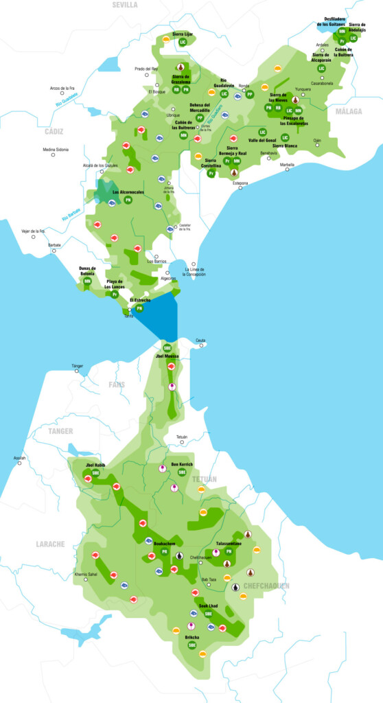
LOS ALCORNOCALES NATURAL PARK: ALGECIRAS, GAUCÍN STATION - EL COLMENAR, LOS BARRIOS AND JIMENA DE LA FRONTERA.
The Los Alcornocales Natural Park extends over 170,000 hectares of land, straddling the provinces of Cádiz and Málaga, and is made up of the largest cork oak forest in the world.
It is one of the most important protected areas in Andalusia, being the third largest park in this land, reaching as far as the Strait of Gibraltar.
Rhododendrons, ferns and laurels grow under the shade of the cork oaks. In its southern part are the canutos, river valleys in which plant species from the Tertiary period survive.
In essence, we are talking about what is known as “the last Mediterranean rainforest”.
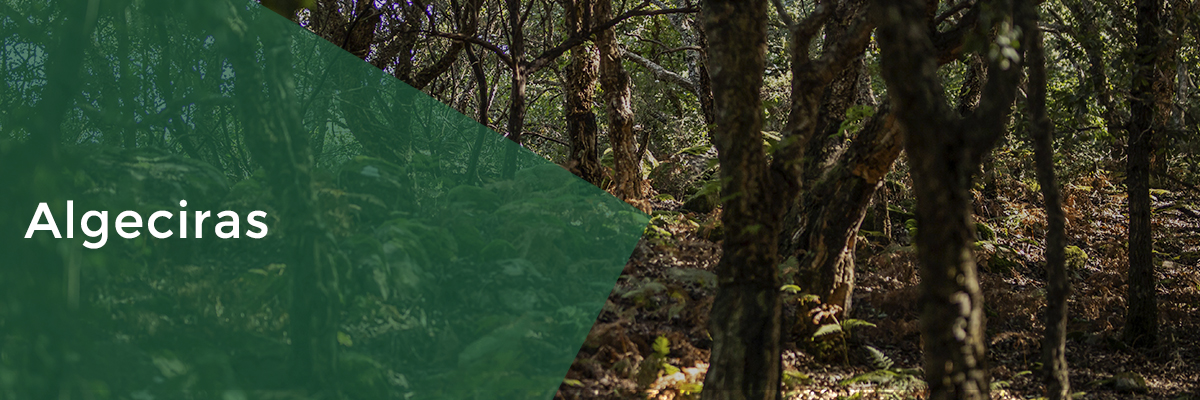
Algeciras is located in a privileged enclave, halfway between the Alcornocales Natural Park and the Strait of Gibraltar Natural Park, both blessed with the influence of one of the most special and legendary places on the planet, the Strait of Gibraltar.
We are talking about an area with the largest cork oak forest on the planet and where, every year, hundreds of thousands of European birds converge.
Places such as the Río de la Miel, in the heart of the Alcornocales Park, or the Punta Carnero lighthouse, one of the most privileged viewpoints of the Strait, are part of the natural heritage of Algeciras.
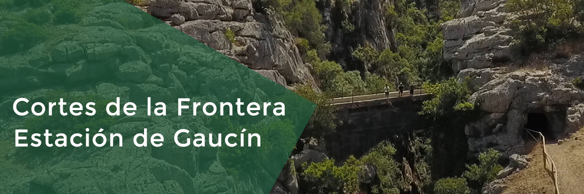
The village of Cortes de la Frontera is situated in a privileged location, between the Natural Park of Los Alcornocales, Sierra de Grazalema and the region of Valle del Guadiaro (River of Gold).
Two of its villages are particularly noteworthy – Cortes de la Frontera and Estación de Gaucín, popularly known as El Colmenar.
The limestone massifs of Grazalema, to the north, and the dense masses of cork trees, to the south, are the protagonists of the landscape surrounding these two small villages in Málaga, home to mountain people, who still live in communion with the nature that surrounds them and know how to make the most of its resources, making them ideal places to connect with nature.
Cork gatherers, mushroom pickers, wood craftsmen, muleteers and lovers of good food all come together in this small community in the deep interior of the province of Málaga.
Walks, such as the ascent to the Puerto de Libar, a karst paradise with spectacular panoramic views of the plains of the same name, or the Cañón de las Buitreras Natural Monument, a place of enormous beauty where a large colony of griffon vultures nests and adorns the skies of these valleys every half day, are a must.
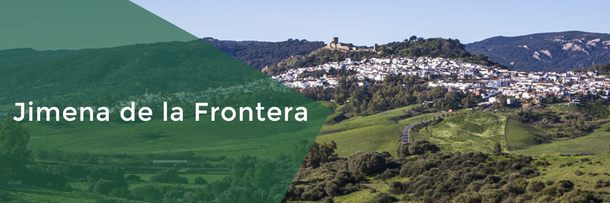
Situated on the border between the old Nasrid Kingdom of Granada and the Kingdom of Castile, Jimena stands on the banks of the crystalline Hozgarganta Hozgarganta River and the Guadiaro River, always crowned by the mighty castle of Islamic that has stood there since the 8th century.
Its location, surrounded by lush forests, is ideal for a multitude of nature activities. Walks such as those of the Hozgarganta, next to the old Royal Artillery Factory built in the time of King Carlos III, or those that can lead us to discover prehistoric sites such as “Laja Alta”, are just some of what this small whitewashed village in the heart of the province of Cádiz has to offer.
Its rich gastronomy, led by seasonal mushrooms and game meats, is another of the attractions that makes it worth paying a visit to this corner of the southern geography.
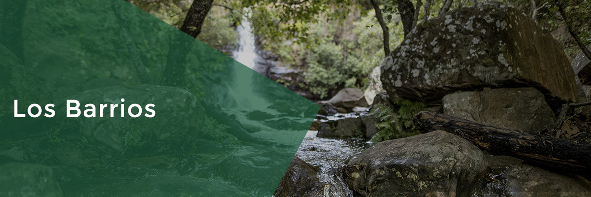
Los Barrios, located in the southernmost part of the Campo de Gibraltar, is one of the thirteen municipalities that make up the Natural Park of Los Alcornocales, occupying seventy percent of its extension.
Surrounded by nature and dream landscapes, La Villa invites tourists to make rural routes of various difficulties and duration for its large forests that have a great biodiversity in terms of fauna and flora.
Places like the Gorges del Prior or El Capitan, offer the visitor a direct immersion in almost paradisiacal landscapes judging by their greenery and freshness, which do justice to the appellation of “Mediterranean jungle” that is usually associated with the Natural Park of Los Alcornocales.
The farm “Monte La Torre”, another of the places to visit, belonging to the Larios family, which houses the bilingual Farm School of the same name, contains a medieval-style watchtower hidden in a beautiful cork oak forest that serves as a privileged vantage point over the entire Campo de Gibraltar.
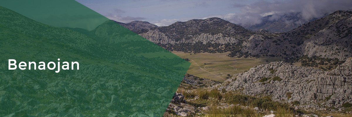
SIERRA DE GRAZALEMA NATURAL PARK: BENAOJÁN
Declared a Biosphere Reserve by Unesco, it has an area of 53,411 hectares and is identified as one of the most ecologically valuable areas in the southern peninsular and therefore of great relevance in the rest of the territory.
It has the highest rainfall index in the Iberian Peninsula, with an annual average of more than 2,000 liters per square meter, and constitutes the most important western massif of the Subbetic mountain ranges.
Its intense rainfall and the limestone nature of the terrain have given rise to a karst landscape rich in steep caves, grottos and caves and winding gorges. It has in its Sierra del Pinar an important forest of Spanish firs, considered a plant relic of the Tertiary period.
This mountainous municipality, located on the border of the Sierra de Grazalema with the Guadiaro Valley, is a paradise of limestone and water, sublimated in one of its most unique places, the Cueva del Gato, who with its 10 kilometers long, is one of the most complex in Andalusia.
Another unique enclave, a must visit, is the Cueva de la Pileta, a reference in Andalusian rock art. Its paintings, almost 150,000 years old, are surprising for their state of preservation and unique enclave.
The Llanos de Libar, constitute one of the best examples of karstic polje of the south peninsular as well as one of the most beautiful landscapes of all Andalusia.
UPPER ROCK NATURE RESERVE: GIBRALTAR
Considered by visitors as one of Gibraltar’s major attractions, the Upper Rock Nature Reserve is home to an important endemic flora as well as animal species such as the Rock Partridge (Perdiz Moruna) and the Barbary Macaque (Macaco de Berbería).
The Gibraltar Nature Reserve is also famous for its unique walking trails, which meander the length of the reserve. These combine the natural beauty and breathtaking views of the reserve with some of the historical sites that are not usually included in the more typical tours. The main trails include the Mediterranean Steps, Inglis Way, Royal Anglian Way and Douglas Path. Four trail networks have been developed: “Nature Lover,” for nature lovers; “History Buff,” a look at Gibraltar’s history; “Thrill Seeker,” for the more adventurous visitor; and “Monkey Trail,” where friendly monkeys take centre stage. Each trail has its own logo to guide users. As part of the revamped trail network, a new Gibraltar Nature Reserve App (GNR App) has been developed and is available for iOS and Android.
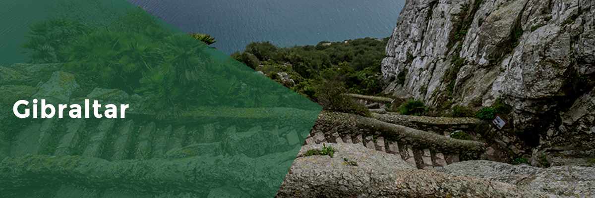
Tarik’s Mountain or Mount Calpe are some of the legendary names by which Gibraltar is known. “The Rock” represents one of the two pillars of the Hercules myth, the union between the two shores of the Eurafrican Territory.
Beyond myths, Gibraltar is a melting pot of cultures present in the Strait of Gibraltar, as well as a range of scenic and cultural attractions that we are sure will not leave you indifferent.
A guided tour of the Gorham Caves Complex (UNESCO), a walk along the vertiginous Mediterranean Steps or a trip into history through the kilometres of tunnels built during the Second World War are some of the must-do things when visiting Gibraltar.
As we can imagine, its strategic location, at one end of the Bay of Algeciras, facing the Mediterranean Sea, makes it a privileged viewpoint over the whole Strait of Gibraltar. O’Hara’s Battery, the recent “Windsor Bridge” and the “Skywalk” are just some examples of the places from where the visitor can enjoy some of the best panoramic views offered by “The Rock”.
TERRITORIO. M DIQ.
PROVINCE OF MDIQ-FNIDEQ: JBL MUSSA NATURAL MONUMENT AND LEILA ISLAND
The north of Morocco hides some of the least known Protected Natural Spaces in the country, such as Bouachem NP, Talassemtane or Jbl Musa, all of them of great ecological and ethnographic value.
The Jbl Musa and its surroundings are located in the middle of the migratory corridor of birdlife, one of the most important on the planet and a privileged place where bird lovers from all corners of the world gather every year to contemplate this spectacle offered by the Strait of Gibraltar.
Here, in the Jbl Musa, begins a beautiful limestone ridge that crosses a large part of the province as far as Tetouan, giving us karst poles such as those of Fas el Hamr in the Sierra del Hauz.
The more than 40 kilometres of fine sandy beaches that connect Fndiq with the river Martil, on the Mediterranean coast, are another of the natural attractions that invite you to discover this authentic province.
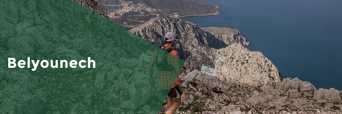
This small town is one of the best-kept treasures of northern Morocco. Its crystal-clear waters and rugged mountains are a paradise for underwater and mountain lovers.
The Jbl (mountain in Arabic) Mousa is a 900-metre high limestone colossus that rises above the blue waters of the Mediterranean. Its scenic value, with Gibraltar and the Spanish coasts in the background, is enormous, as is the harshness of its paths, frequented only by a few goats that give a good account of the enormous mastic trees that survive on its slopes and the colony of Barbary macaques that are the real lords and masters of this mountain.
The local water culture, which is characterised by a large number of springs that gush forth from the limestone bowels of these mountains and which have provided water to Ceuta since the time of the Spanish Protectorate, is evident when strolling through its streets.
The famous islet of Perejil, Isla Leila for the locals, emerges next to the jagged coastline, so close that it seems almost like a small appendage of it. Originally, Parsley Island was called the island of Calypso, as legend has it that it was here that Ulysses was imprisoned by the charms of this nymph, according to Homer in the Odyssey.
M’Diq
M’Diq is a beautiful village of Moroccan fishermen, located on the first kilometres of the Mediterranean coast of the province.
It is an eminently touristy town. Its well-kept and urbanised beaches stretch from Restinga in the north to Cabo Negro in the south, past the famous developments of Marina Smir and Kabila, both with marinas. This coastline, touristically called Tamuda Bay, is one of the country’s most important holiday resorts. The presence of a royal residence near the town, much visited by the king, adds to the attractiveness and number of visitors to this coast. The town’s most important activities are beach tourism and fishing. Its fishing port is home to a large fleet operating in the Mediterranean.
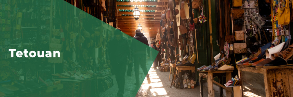
Tetouan
The White Dove, it is called, in a clear metaphor for its predominant colour, and also because of the terrain and the place where it was built, which seems to take flight at any moment. Tetouan is a Mediterranean pearl, it has one of the most beautiful medinas in the Maghreb (protected and recognised by UNESCO as a World Heritage Site), and in addition, despite being at sea level, it is surrounded by mighty mountains that rise to over 1,800m a few kilometres from its bustling streets.
For centuries, this lively city was a fundamental destination, a meeting place for the cultures of the Straits, and even today it still maintains that mixed air, that spiritual connection with the Andalusian.

